Tuesday 18 January 2011

Hard times...


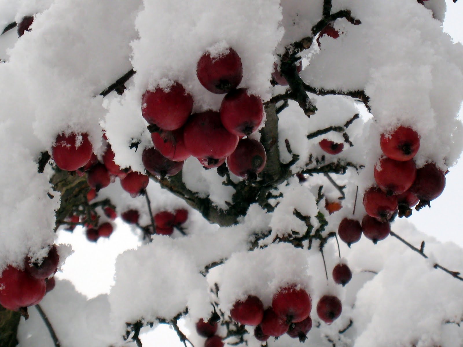
One of my earlier efforts (Jan 2008) had the title "Remember snow?". There had been quite a few winters when snow was in short supply and talk of global warming had lulled us into thinking that from now on winters would probably be mild and wet. So last year, and especially this year, things have changed, and a few pictures of our snowbound back garden should put the record straight.This has been a hard winter, but not yet as severe as 1963, (as you will of course remember from my Jan 2007 entry). I do recall a couple of lines in a poem someone had written at that time addressed to those who had spoken of earlier harsh winters.... " We've had, Old Timers, and you know it's true, a harder winter than you ever knew ! " So there you go ! What goes around comes around, as they say. Although not quite yet. But then it's still only January!


Sunday 25 April 2010

Voices from the prehistoric.

This wonderful stone is at Washbeck Green, Barningham Moor, in the Tees Valley. Not easy to find and to protect the surface turf has been laid on the stone. If you manage to find the stone you should replace the turf after looking. The cup and ring marking is on Long Meg (mentioned below). What does it all mean ?


There are about fifty prehistoric stone circles in Cumbria, the most famous being Long Meg and Her Daughters (near Penrith), Castlerigg (near Keswick), and Swinside near Broughton -in-Furness. Castlerigg and Swinside are in wonderful settings and Long Meg too has a fine position with the Pennine Fells as a backcloth. Nobody really knows their purpose but they were obviously very special places about 5000 years ago, as they still are. Most probably they were places of worship and where those who made the circles could pay their respects to their dead.

Prehistoric rock art of "cup and ring" carvings exists throughout Northern Britain especially in Northumberland and Durham but is also found in Ireland. A recent book by Paul and Barbara Brown (Prehistoric Rock Art in the Northern Dales) suggests a possible link between the Cumbrian stone circles with the rock art of the sandstone boulders, particularly on Barningham Moor (and surrounding areas) in the Tees Valley. Possibly this was on a routeway via the Stainmore Gap leading to those special places. Many rocks in the area are marked with cups or cups and rings. What do the markings mean ? Perhaps simply an art form and clearly some of the stones are more expertly carved than others. Or is there something else behind the carvings ? We can only guess !

The Barningham Moor setting like the Cumbrian circles is stunning. Obviously the man-made landscape of today would have been different 5000 years ago but the outline of the hills cannot have been much different. The sun would have risen and set in the same way and the seasons would have come and gone. My pictures are from two recent visits to Barningham Moor and a few days in the Lake District. You really have to go to these places to get the feeling of their power.


Washbeck Green, Barningham Moor.


View towards Washbeck Green. Not easy to find that very special stone!

Osmond Gill. (Osmaril Gill on O.S. map).

Stone in Osmond Gill.

The Eel Hill stone. (below).


View over Barningham Moor from Eel Hill.

Saturday 6 February 2010

Lake District pick & mix...

Happy days spent in the Lakes ! An excuse to upload some pictures from days before all of the modern technology which has entered our lives. (Without which I wouldn't be able to upload these pictures !). The farm above is not far from Wordsworth's Dove Cottage, near Grasmere.


The shots here are of Bowfell from Pike O'Blisco. High Spy and the Newlands Round. Hall's Fell Ridge, Blencathra.

Above is the Kentmere Horse-shoe - Froswick, from Ill Bell. Caught in the mist below, climbing High Street, from Haweswater.

Great Gable and Kirk Fell from High Stile. Below, Helvellyn and Striding Edge.


Coledale Hause and Eel Crag above. Ullswater from Gowbarrow below.

Eel Crag and Sail from the Causey Pike ridge. Pike o' Stickle and the Langdale Pikes. Whiteside and Hopegill Head. Ennerdale Water from Red Pike.


The sunsets are Derwentwater and Ullswater.

Posted by Picasa

Sunday 17 January 2010

Winter tales.


It's wonderful living just outside of our Northern Dales and to go there when the worst of the serious weather is over ! The Swaledale sheep can tough it out for sure, not forgetting the equally hardy farmers who look after them in all weathers.
The weather may not have been too bad in recent years but even we have had our moments !


Saturday 16 January 2010

A touch of the white stuff.


A late Autumn holiday, or maybe early Spring. You weren't expecting it, but you got it anyway - and it looks great. Snow on the Lake District fells ! These pictures were taken some years ago (in pre-digital photography days). On Skiddaw it was so cold the camera decided to pack it up for the day until things had warmed up a bit !


Castlerigg Stone Circle, near Keswick. What a position, surrounded by high fells !

The views above are Ullswater, The Langdale Pikes, Wetherlam, Skiddaw and Blencathra.